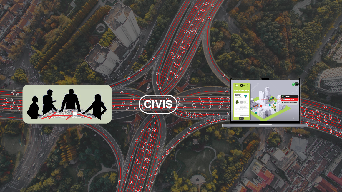
Sim City for Real-Life Cities: CIVIS aims to be the premier digital twin platform, enabling the collection, storage, analysis, and simulation of critical city infrastructure. With a focus on active community management and prioritization, CIVIS is set to transform digital maps into dynamic tools for enhancing strategic urban areas.
Problem Statement:
Modern cities are growing with rapid, uncontrolled expansion, further complicated by ever-changing regulations and governance. This chaos often leads to the loss or obfuscation of essential urban data, resulting in disjointed and inefficient urban development.
Solution:
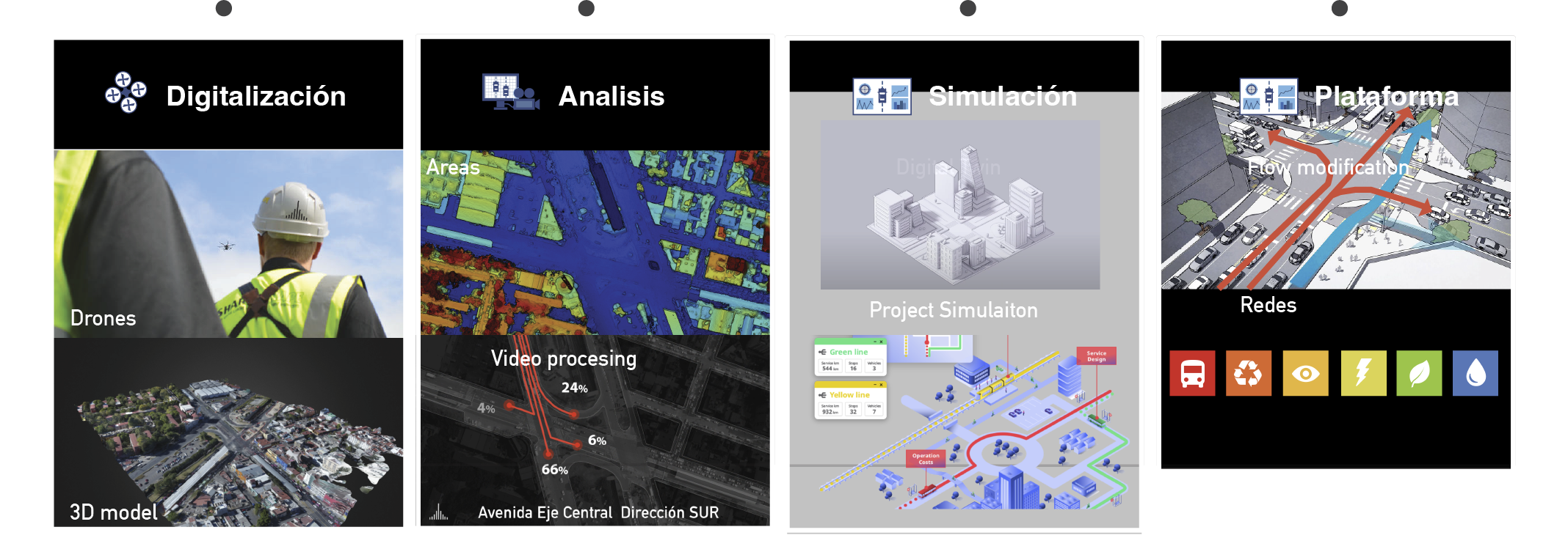
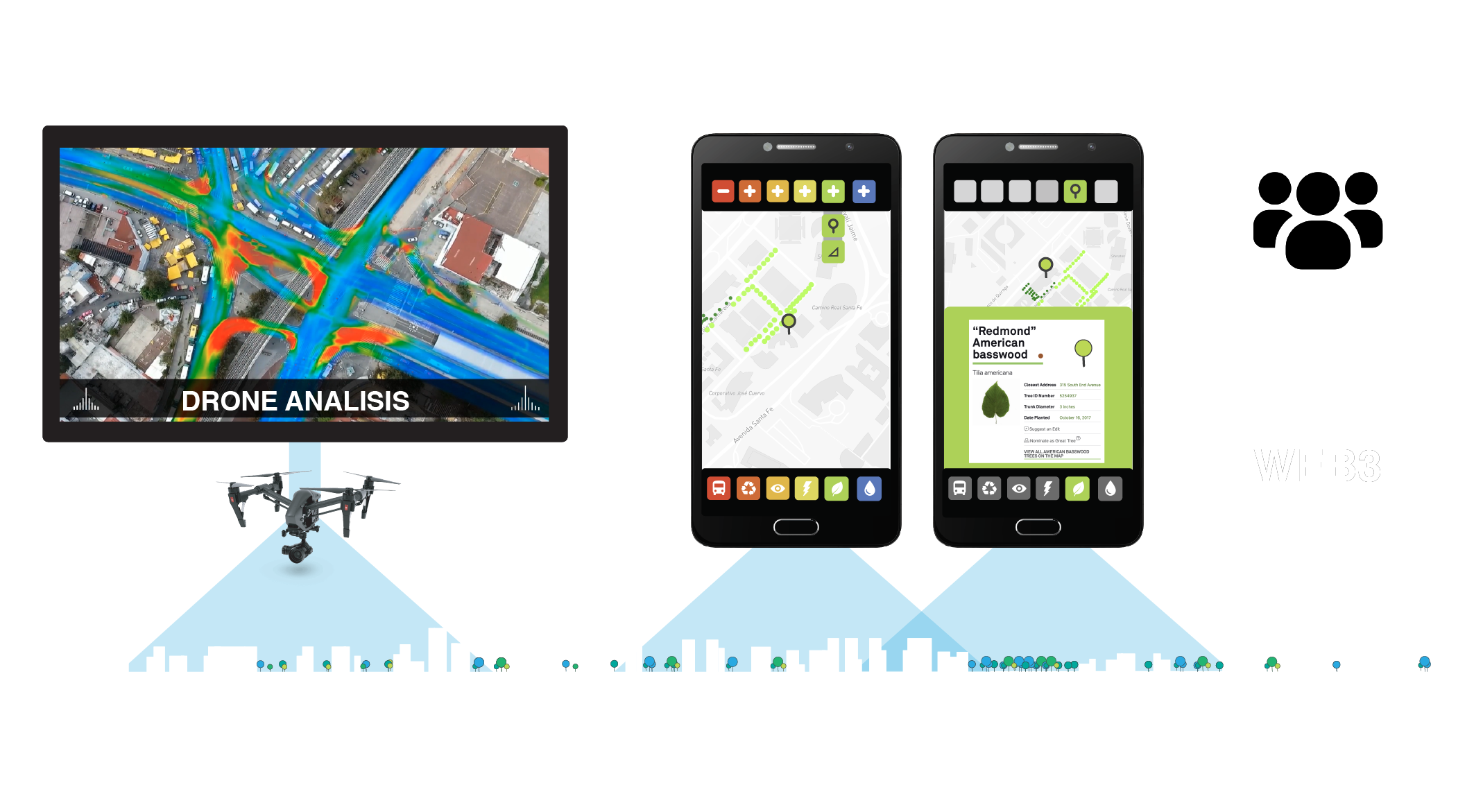
Over the past five years, Cities of the Future (citiesofthefuture.org) has amassed a vast database of global projects. We have meticulously gathered city-specific data, creating detailed project profiles with photos, diagrams, digital maps, and YouTube videos. The next step is to develop a map-based platform to overlay diverse urban infrastructure networks.
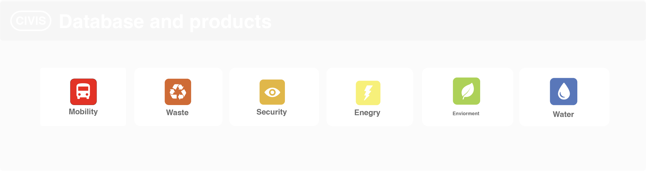
We are initially focusing on six pillars for digitalization:
Mobility (Streets, sidewalks, stations, bus stops, digital transport schedules (GTFS))
Phase 1 – : Development of a Web App Pilot, focusing on interface design, user experience, and interactive visualizations.
Phase 2 – : Creation of a Mobile App Pilot, with an emphasis on environmental and mobility aspects.
Phase 3 – : ‘Vallejo-I Digitalization’ – Digitally mapping Mexico City’s Vallejo-I, a technology and innovation district.
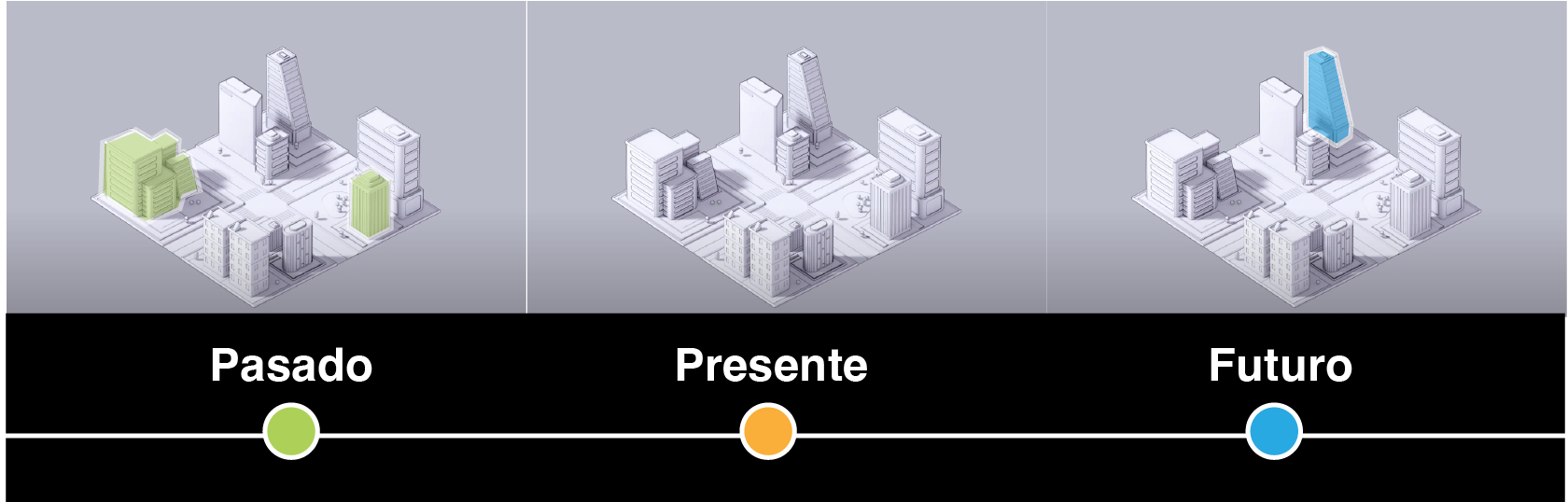
The Future Vision:
Our ambition extends to digitally replicating cities worldwide, fostering continuous updates, and providing analytical insights into global urban projects. With CIVIS, we aim to transform urban planning and enhance community engagement, striving for cities that are efficient, sustainable, and resonate with their residents’ needs.
Key Goals:
Develop an evaluation system to score projects based on our six pillars and various design strategies and technologies.
Introduce tokenization of urban infrastructure projects for real-world applicability.
Maintain a free, accessible platform for users.
Background:
Since our inception in 2016, we’ve evolved from a blog to a vibrant online community with over 33,000 subscribers. Our “urban radiography” projects in Mexico City exemplify our commitment to using advanced tools like drones and video processing for urban analysis. These initiatives underscore our data-driven, practical approach to enhancing city planning through innovation.